The problem
Whoever designs a residence spends months validating parameters against codes and decrees: zoning (does the zone allow housing?), zoning ordinance (what is the occupancy rate?), floor-area ratio (how much construction per m² of lot?), setbacks (front, rear, side), permeable area (how much of the lot must stay uncovered?). Each city hall has its own criteria — legislation living in old PDFs, shared spreadsheets, conversations with a project analyst.
The engine
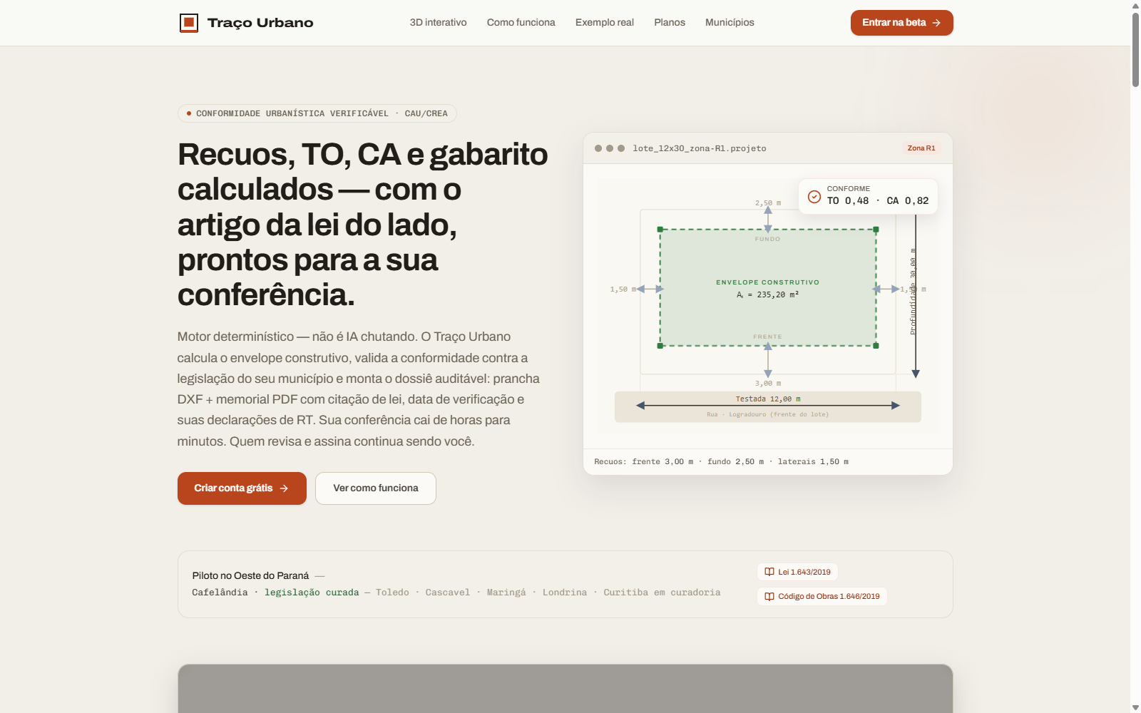
Traço Urbano encodes regulatory geometry into a deterministic machine that transforms lot + zoning into a buildable envelope:
- Captures the lot — terrain polygon with bearing and boundaries.
- Queries regulation — RAG searches parameters in the curated corpus (zoning ordinance, FAR, setbacks, etc.).
- Calculates envelope — Shapely applies geometric limits (linear setbacks, FAR by projection, permeable area per zone).
- Validates compliance — each rule is audited; violations surface in a report.
- Exports — technical DXF (AutoCAD/Revit compatible) + PDF memo with calculation memory.
Fail-closed philosophy
The system never claims authority beyond what it calculates deterministically. A parameter missing or ambiguous in the corpus never backs an opinion — the interface flags the gap instead of guessing. Legal responsibility always belongs to the licensed professional: the ART/RRT signature stays human, by product decision.
Data curation
Each municipality is a research project: zoning legislation, occupancy regulations, public land databases (if any). The system is only as good as the quality of that corpus. One well-curated city (Cafelândia-PR verified) opens the door to pilots in the region — western Paraná — but it is not a copy-paste model: each municipality needs its own sweep.
On screen
My role
Conception and architecture of the geometric engine, fail-closed validation design, RAG integration, curation of the first municipal corpus, regional pilot. Independent product, built with regulatory responsibility first.
Traço Urbano is an independent solution. Software, brands and regulations cited belong to their respective owners.